+ ROUTES
1, 2, 3, 4 - Northeast Face
- Season: Spring, Summer
- Exposure: Northeast to East
- Vertical: 400' - 600'
- Approach Elevations: 10,120' - 12,814'
- Approach Distance: From Fourth of July TH: 3.75 miles
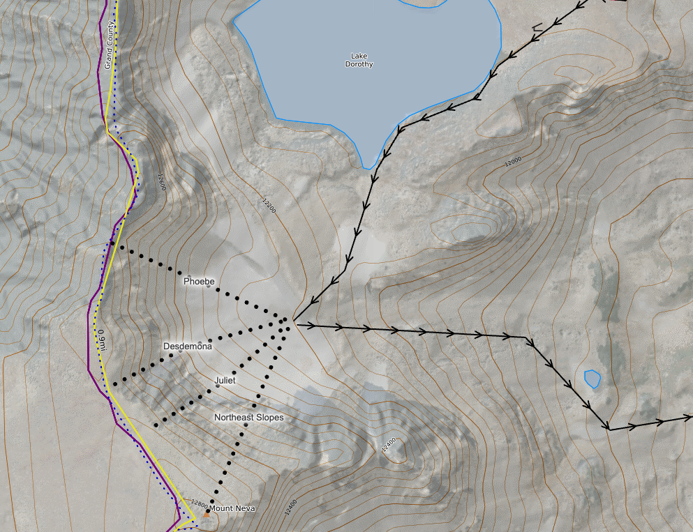
Shared Approach to Lake Dorothy (12,061’)
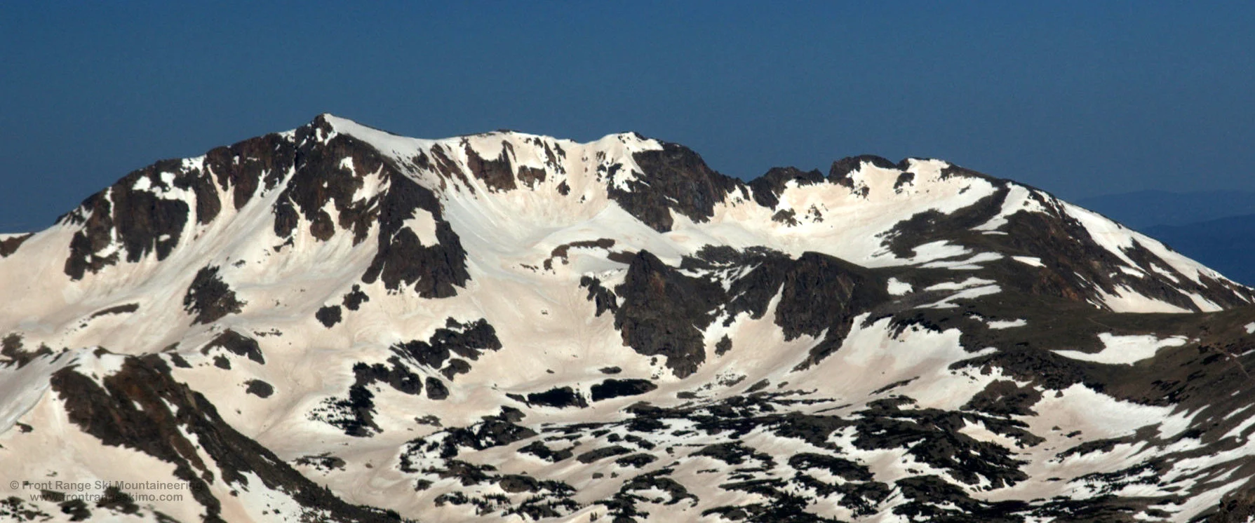
The Fourth of July Trail leaves the trailhead on the north side of the parking lot. The trail traverses the south facing slopes to the Fourth of July Mine and then Arapaho Pass via an old carriage road. The trail is easy to follow even if snow covered, but in the spring mountaineering season the trail can be melted out below tree line. Hike about 1.7 miles to the Fourth of July Mine, and then 1 mile to Arapaho Pass. From Arapaho pass continue 0.4 miles to Lake Dorothy (12,061’). In the summer there is a trail from the pass to the Lake. The four short routes described below are south of the lake. Climb south of the lake and to the left of the large buttress below Point 12,700’. The bowl containing these chutes drains to the east and not to Lake Dorothy. These routes receive sunlight at sunrise.
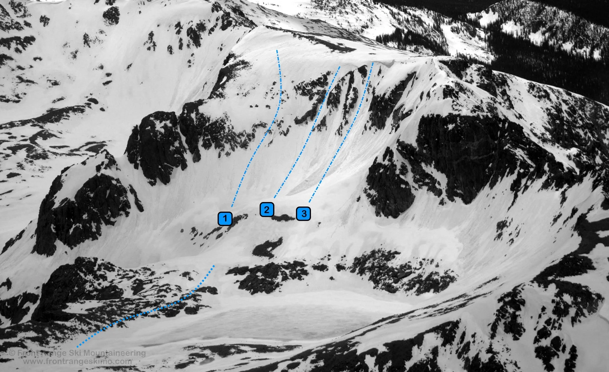
1 – Northeast Slopes (II D6) – These slopes are the most moderate of the lines on this side of Neva, and the most direct line to the summit. Get here in May as the slopes melt quickly and expose rock.
2 – Juliet (II D7) – Juliet is the first couloir to the looker’s right of the Northeast Slopes and is the most popular of the chutes. It is generally without a cornice. Check for mountaineers climbing up this couloir before you drop in and clearly communicate with them.
3 – Desdemona (II D9 R3) – Desdemona is to the right of Juliet and is split into two upper chutes. Both are capped by cornices.
4 – Phoebe (II, D13) – Phoebe is the common name for a series of chutes to the right of Desdemona and to the left of Pont 12,700’. The climber’s right side is most frequently climbed and skied as it does not have a cornice on the top. Some Class 3 scrambling is needed to get to the easy open slopes that lead to the summit.
+ TRAILHEAD
Fourth of July Trailhead (10,120')
Use the Fourth of July Trailhead to access the routes on Mount Neva. Past the town of Eldora, the Fourth of July Road sporadically melts out by late May depending on the snowpack. Even when this road appears open there can be snowbanks that require caution and high clearance to drive through. Parts of the road are exposed to the sun and other parts are in dark timber. To get to the Fourth of July Trailhead, drive west on County Road 130 from the town of Nederland towards the Eldora Ski area. At the left turn to the Eldora Ski area, continue straight to the town of Eldora. Continue straight and drive slowly through the town of Eldora to the west end of town and then proceed west on Road 111 about 5 miles to the dead-end at the Fourth of July Trailhead. The Fourth of July Trailhead is the access point to one of the Front Range’s great ski mountaineering arenas.
+ MAPS & PICTURES
Below we have included a link to Front Range Skimo's master map. The routes on the map are approximations, and are not intended for use as a GPX track. To the right are a curated list of photos of the mountain.