Mount Achonee 12,659'
Mount Achonee from the northeast. Photo: Rob Writz
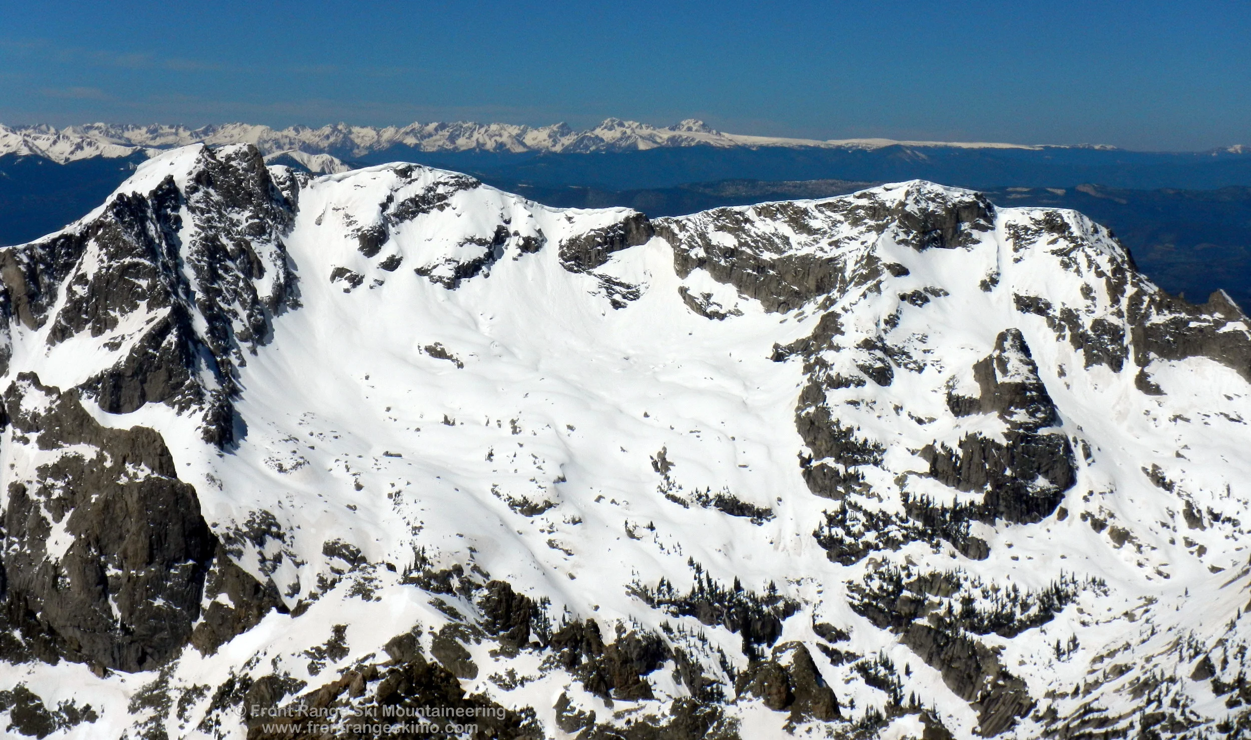
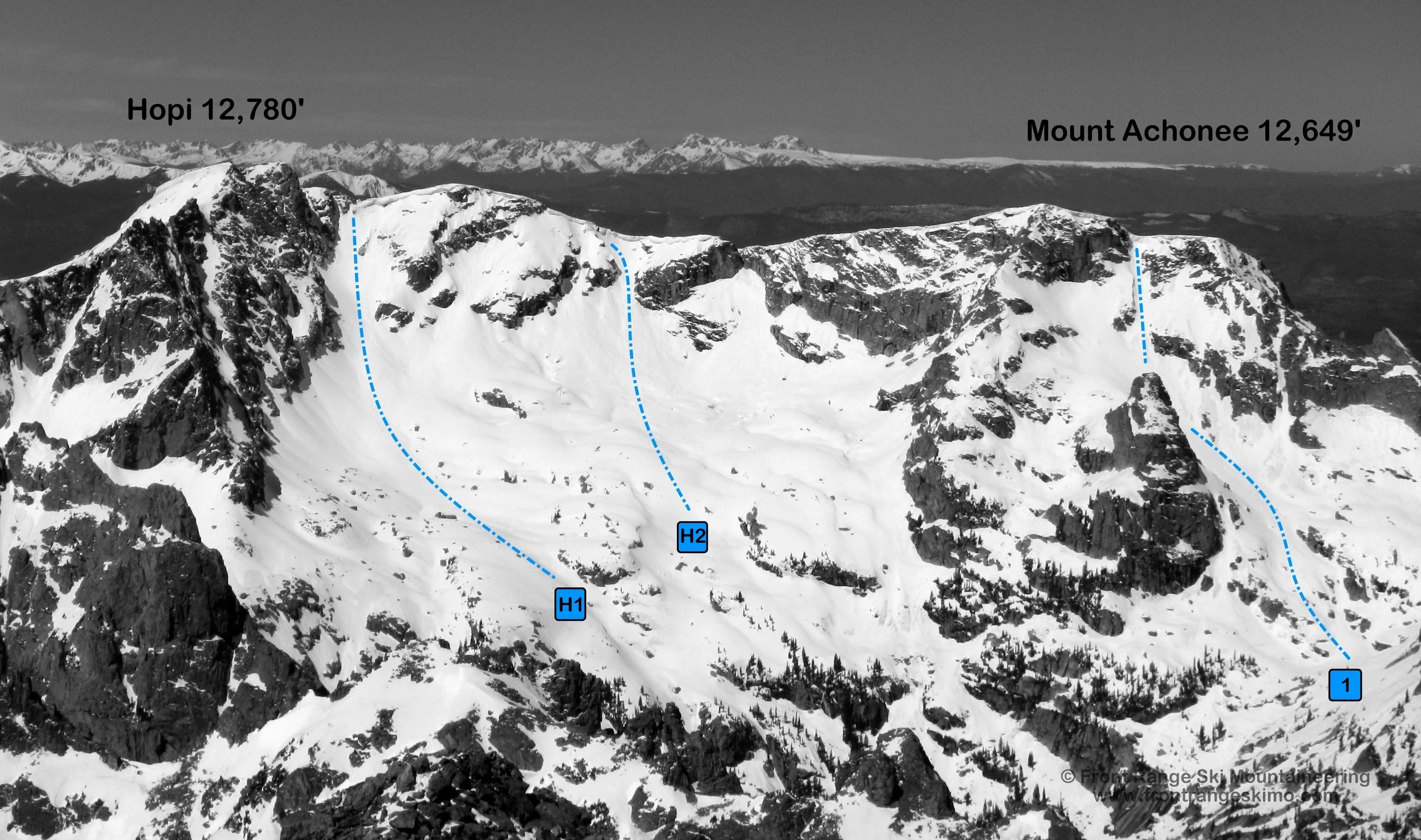
The north side of Mount Achonee is well hidden. It sits on the West Rim of the Lone Eagle Cirque and is guarded from the view of approaching skiers and hikers by Cherokee. Achonee’s vertical east and north faces hold large cliffs that have very few weaknesses. When you arrive at Crater Lake the peak is challenging to see as it is blocked by the walls of the Achonee Tower, a rock spire that rises northeast of the peak. Mount Achonee holds the Achonee Arrow, one of the steepest ski lines in the region. Like Hopi Glacier, there is a spectacular bowl below the Achonee Arrow that has numerous ski lines. This area gets sunlight much earlier in the morning than the Fair Glacier and Peck Glacier.
+ ROUTES
Route 1 - Achonee Arrow
- Rating: V* D16 R3
- Season: Spring, Summer
- Exposure: Northeast
- Vertical: 2,100’
- Approach Elevations: 8,340’ - 12,400’
- Approach Distance: From Crater Lake: 1.1 miles, From Monarch Lake TH: 7.6 Miles
The Achonee Arrow is one of the steepest lines around. In June this is a consistent snow line from the Northeast Ridge of Achonee all the way to Crater Lake. The climb from Crater Lake to the base of the steep couloir reveals a huge snow bowl that is moderate and filled with a variety of terrain to explore. The “Arrow” itself is where the couloir climbs from behind the Achonee Tower to Achonee’s Northeast Ridge. The upper portion of the couloir can be sustained 55 degrees, vertical, or overhanging depending on how the winter’s wind blew. When you reach this point, determine if you want to ski down from here, or accept the challenge of climbing to the ridge.
*This is a Grade II route from a high camp in the Lone Eagle Cirque.
There are several ways to access the ski mountaineering routes in the cirques surrounding Lone Eagle. The approach that we describe here is to start at the Monarch Lake Trailhead southeast of Lake Granby in Grand County. This approach is straightforward and beautiful. You should plan on spending several days in this area: one day to hike in, several days to ski from a basecamp, and one day to hike out. No matter how long you stay in this area you will leave wishing you had planned for several more days because it is that good.
Most Front Range skiers explore the Lone Eagle area after Memorial Day. The Cascade Creek Trail is often dry to just beyond the junction of the Crater Lake Trail (approximately 10,080’). You will want to bring hiking boots for the majority of the approach, skins for the valleys below the cirque, and crampons for the glaciers and snowfields.
From the Monarch Lake Trailhead follow the Cascade Creek Trail east across the north side of Monarch Lake. The trail continues eastward 3.1 miles to the intersection with the Buchanan Pass Trail. Hike on the Cascade Creek Trail to the southeast 2.7 miles to the junction with the Pawnee Pass Trail and Crater Lake Trail. Cross Pawnee Creek and go south on the Crater Lake Trail, and within a half mile look for a camping spot to the east (left) in lower angle and sometimes dry terrain. There is often snow at Crater Lake, and this positions north and east of Mirror Lake are good for a basecamp. From this area it is about a quarter mile southwest to Mirror Lake and then a quick jaunt to Crater Lake.
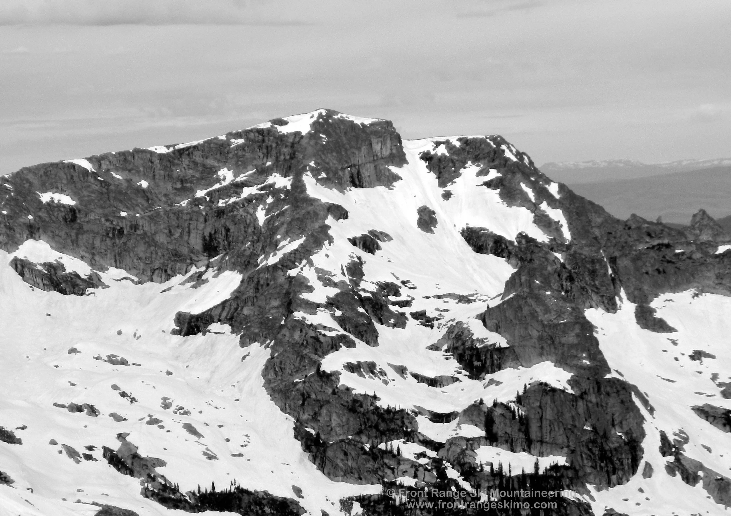
At Mirror Lake head southwest through the trees to Crater Lake. Go around the lake on the north (right) side and then climb west and northwest around slabs keeping the Achonee Tower to the climber’s left and Cherokee to the climber’s right. There is a small basin near 11,200’. From here begin heading south towards Achonee proper and the intimidating Achonee Arrow. There are vertical rock walls all around you here and the Arrow is the couloir piercing the walls surrounding Achonee. There is an option to escape the vertical cornice exit and that is to the climber’s right. The snow here is still very steep and you are now exposed over a cliff.
+ TRAILHEAD
Monarch Lake Trailhead (8,340’)
Monarch Lake Trailhead is on the west side of the Continental Divide east of Grand Lake and the town of Granby. From the town of Granby, drive north on Highway 34 to Lake Granby’s Rainbow Bay and turn east on County Road 6 towards Arapaho Bay. Follow this about 10 miles east to the Monarch Lake Trailhead.
This trailhead is in the Arapaho National Recreation Area. There is a $5 per day vehicle fee and you can learn more about it at the ANRA website. Additionally, a wilderness permit is required for camping in the Indian Peaks Wilderness. The Arapaho and Roosevelt National Forest website has more information on this. The Sulfur Ranger District headquarters in Granby is a good central location for information on the recreation area and the wilderness area.
+ MAPS & PICTURES
Below we have included a link to a Google interactive map and a curated list of photos of the mountain.

Clicking on map above will open interactive Google map website