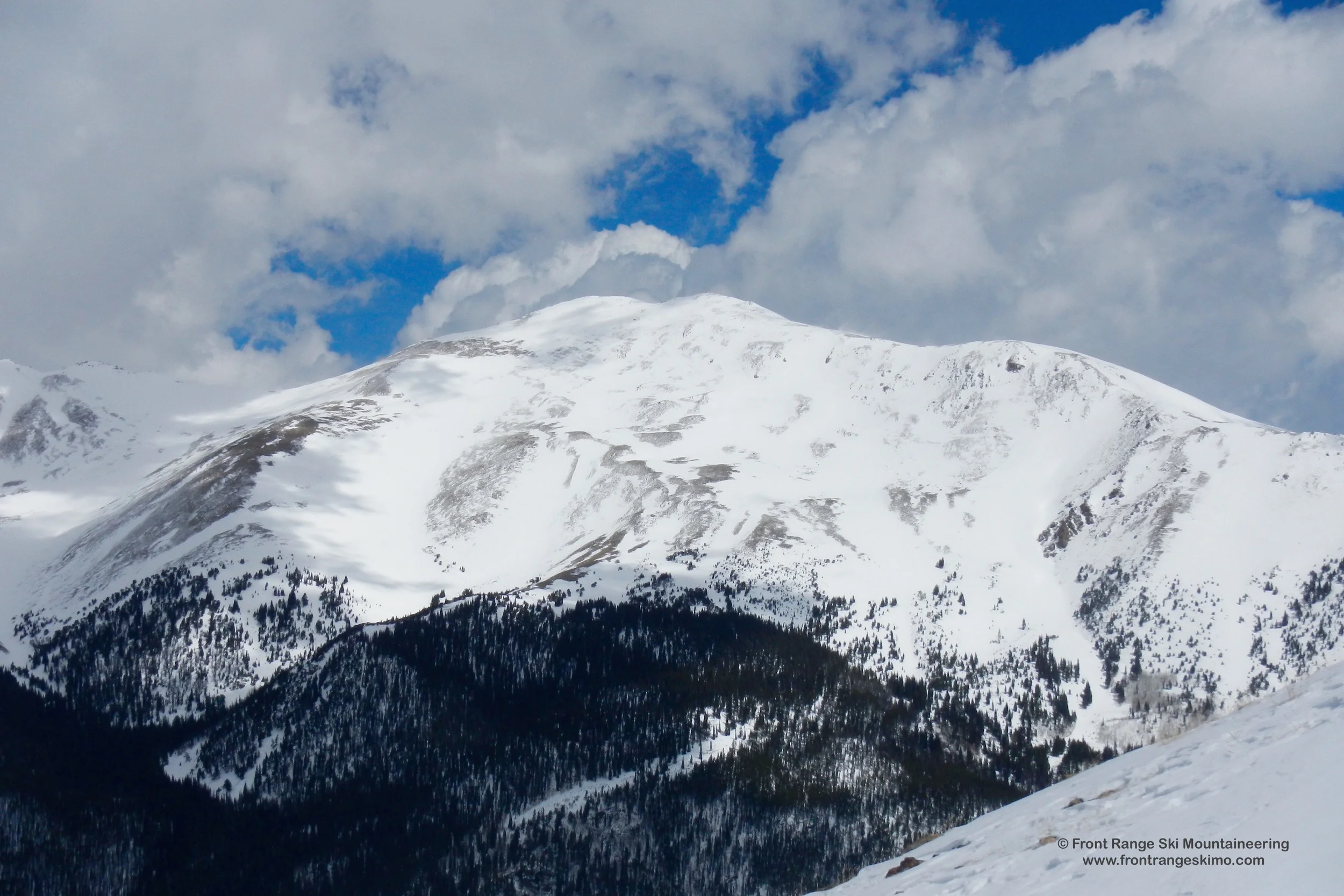
Bard Peak 13,641'
Bard Peak from the South. Photo: Rob Writz
Bard Peak is so close, yet so far away. The mountain lurks above Interstate 70, and the summit is only a few miles from the Bakersville exit. From this access point it is a steep hike and potential bushwhack to Shakespeare and the mountain’s south slopes. The East Slopes are far from the town of Empire, and require a high clearance 4-wheel drive vehicle and patience. Most summer hikers avoid these approaches and access Bard via the ridge to Mount Parnassus. The mountain is a gentle slope with the exception of the extremely steep Northwest Face. There is a fickle snow line on this aspect that runs from the bottom left of the face to the upper right. Bard Peak’s summit and slopes are quiet places that most skiers and split boarders are likely have to themselves. When you are at this summit, plan on spending time enjoying the outstanding views of Grays and Torreys Peaks.
+ ROUTES
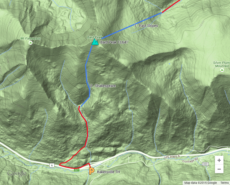
Routes
1 – East Slopes
- Rating: III D5
- Season: Spring
- Exposure: East
- Vertical: 2,000’
- Approach Elevations:
- Approach Distance: From Bard Creek TH: 3.75 miles, from Empire Pass: 7 miles
- Top of Route Waypoint: 39.7203, -105.8043
There is the opportunity for a quick view of Bard’s East Slopes when you are driving east on Interstate 70. As you approach the exit to Empire look up and west. These slopes are often windswept through most of the winter and upslope storms are what make skiing possible here in the spring.
The East Slopes can be a long hike if you do not have a high clearance 4-wheel drive vehicle as well as the patience to drive the Bard Creek Road. At Empire Pass there is an exposed technical maneuver required. The road is often dry from Empire Pass into the Bard Creek Valley and you can hike just over three miles to the summer trailhead or drive the road with your rig. From the summer trailhead the trail may be clear and it parallels Bard Creek up the valley. At approximately 11,200’ separate from the Bard Creek Trail and follow the valley southwest to timberline and the East Slopes.
2– Shakespeare
- Rating: II D2
- Season: Spring
- Exposure: South
- Vertical: 2,000’
- Approach Elevations: 9,785’ – 13,641’
- Approach Distance: From Bakersville TH: 2.75 Miles
- Top of Route Waypoint: 39.7203, -105.8043
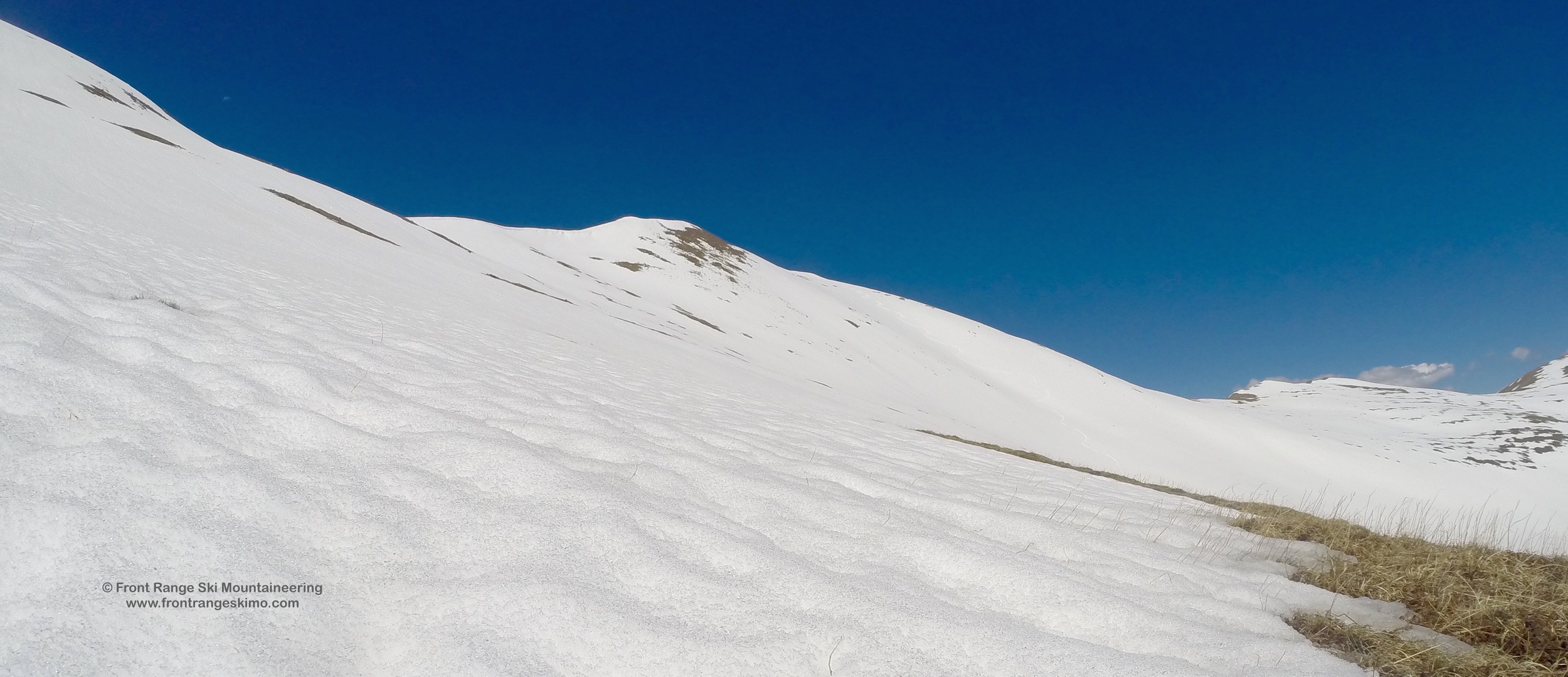
Solitude should be the name of this route. Enjoy a quiet experience in a valley that is not visited by many people. It will be just you, the bristlecone pines, and the elk. The broad and sweeping south slope of Bard Peak is best in June when you can find the approach trail once the snow is gone.
From the parking at Bakersville, cross over the Interstate on the bridge. Walk nearly one half mile along westbound I-70 to the big rig chain up area. About fifteen to twenty yards past the “Chain Law Enforced When Flashing” sign look for an obscure trail heading north and uphill. [39.6927, -105.8141] In the forest look for some orange flagging and several rock cairns marking a fading trail that heads east paralleling the highway and then northeast. Follow this sporadic trail northeast towards the creek that you saw by the Bakersville exit. The trail will be both well defined and nonexistent at points. Keep the creek to your right. After the steep push through the forest the terrain flattens out and then opens into the bristlecone and limber pines near tree line. Climb up Shakespeare to the summit, or up the valley to the west to the Bard-Parnassus saddle.
+ TRAILHEAD
Bard Creek Trailhead (8,780’ or 10,140’)
The east side of Bard Peak can be accessed via the rough Bard Creek Road. In the town of Empire, CO drive south on Main Street (Bard Creek Road), pass the lakes and climb to Empire Pass (1.2 miles). At this point the road becomes very rough requiring high clearance four-wheel drive. [39.7432, -105.6858] You can hike from here if needed. When the road is melted out you can drive 3.17miles to the end of Bard Creek Road. [39.7359, -105.7371]
Bakersville Exit (9,800’)
The south side of Bard Peak is accessed via Exit 221 on Interstate 70. This is the Bakersville exit. Exit the interstate and decide if you want to park on the north side of the exit or on the south side. The north side of the exit has limited parking, but it is directly adjacent to the south slopes of Bard Peak. Just to the south and over Interstate 70 is a large parking area. This is where skiers park to access Stevens Gulch to the south. There is ample parking here. [39.6931, -105.8056]
+ MAPS & PICTURES
Below we have included a link to a Google interactive map and a curated list of photos of the mountain.

Clicking on map above will open interactive Google map website