Frosty Mountain, 12,000'
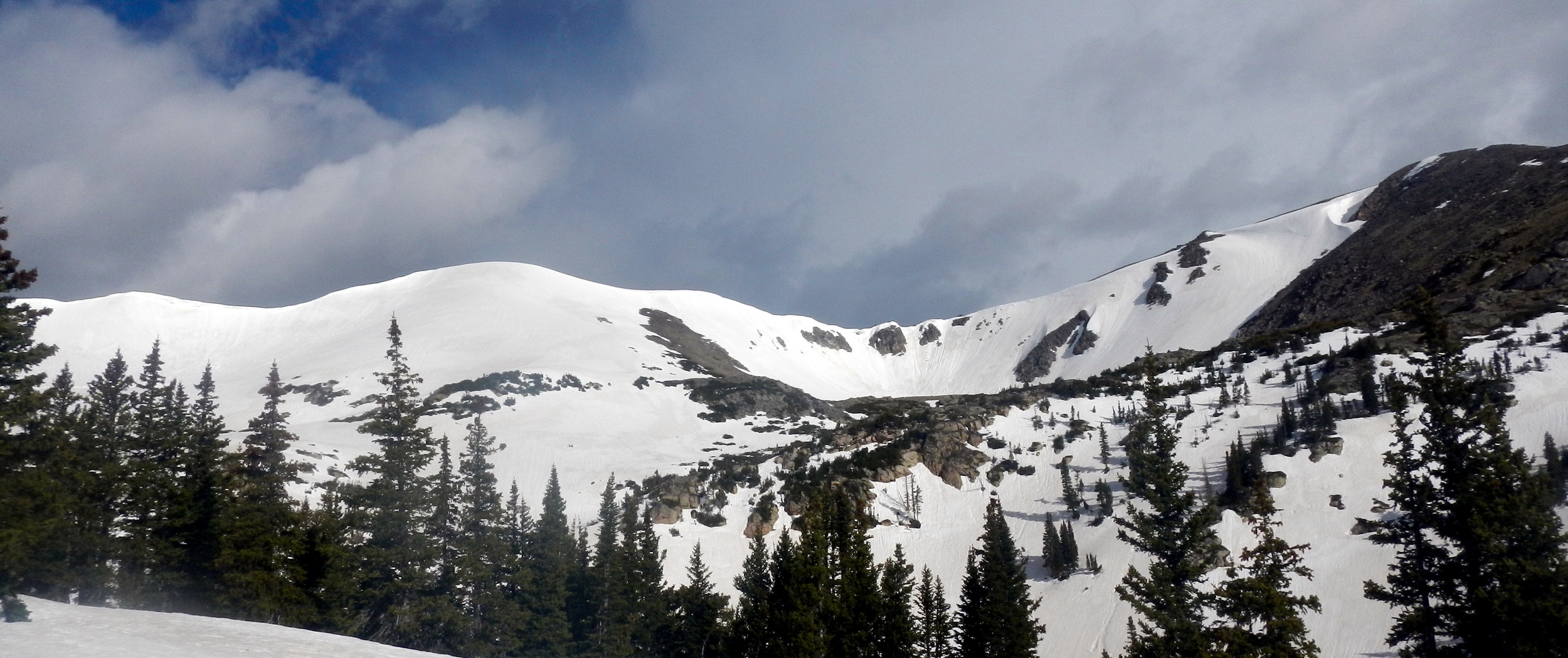
Frosty Mountain from the east. Photo: Rob Writz
Frosty Mountain is an unnamed point on the Continental Divide west of Rollinsville. It is located south of Radiobeacon Mountain and north of Sprint Peak. Frosty Mountain holds a very wide east facing bowl that has numerous ski lines. There is a lot of opportunity for exploring new lines and different aspects in this bowl. Assuming the winds have died down, Frosty Mountain is a great mountain for spring powder on a stable consolidated base. This is a great area to explore the James Peak Wilderness without the full day commitment of bushwhacking into the Heart Lake or Crater Lake cirques.
+ ROUTES
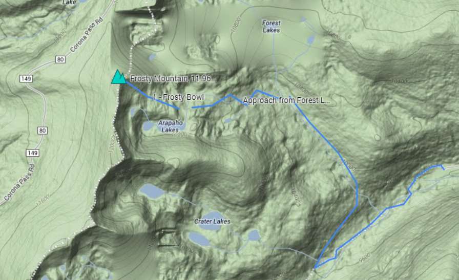
Route 1 - Frosty Bowl
- Rating: II D5
- Season: Spring
- Exposure: East
- Vertical: 800'
- Approach Elevations: 9,211' - 12,000'
- Approach Distance: From East Portal Trailhead: 4.2 miles
The Frosty Bowl is a nearly mile wide area just north of Arapaho Lakes. There are many lines to explore across Frosty Bowl, so have at it! Large cornices surround the Frosty bowl, and the ski line noted here is the obvious route that is not covered by a cornice at the top. This fun route is moderate but has a few steep turns at the top before you can let it go on open slopes. Be careful if you ski this in unconsolidated snow as the convex shapes at the top of this line can be dangerously loaded with the potential to slide. You don't want to be up here in low light as vision is critical on Frosty.
From the East Portal Trailhead at Moffat Tunnel ski 1.2 miles south on the South Boulder Creek Trail to the signed intersection with the Forest Lakes. Take the Forest Lakes Trail north and northwest. At about 10,000 bear left off of the Forest Lakes Trail to the line of an old trail. If it is snow covered it may have been packed down by winter skiers. This is not a trail in the summer as this trail was closed in favor of the trail to Forest Lakes. Keep Arapaho Creek on your left and ski northwest to a meadow at 10,240’ (about 1.5 miles from South Boulder and Forest Lakes intersection). Switchback up the forested headwall for about 640 vertical feet. A good guide through this forest is to follow the line of Arapaho Creek to tree line. From tree line, ski across rolling terrain and past krumholz due west to Frosty.
+ TRAILHEAD
East Portal Trailhead (9,210’)
The East Portal Trailhead is one of the primary entry points into the James Peak Wilderness. To find this trailhead, drive west on Rollins Pass Road (Road 16) from Rollinsville on Highway 119 south of Nederland and north of Blackhawk. Take this road west to the dead-end at the large and obvious trailhead where the train tracks disappear into the Moffat Tunnel. This is a very popular trailhead in the summer and the winter, and it provides access to several trails off of South Boulder Creek. Be prepared to put your boots on in the car because the wind at this parking lot is legendary. The South Boulder Creek Trail is the main vein to access Forest Lakes Trail, Crater Lakes Trail, and Heart Lake. Look for this trail on the north and west side of the railroad tracks. It will lead you around and west of the tunnel. Please don’t cross the railroad tracks or go near the tunnel. You might trigger the annoying warning speakers that bark at you in various languages and suck the life out of everyone’s wilderness experience. [39.903, -105.6442]
+ MAPS & PICTURES
Below we have included a link to a Google interactive map and a curated list of photos of the mountain.
Clicking on map above will open interactive Google map website