This last weekend the Front Range Ski Mountaineering R&D team rolled up to southeast Wyoming for a quick trip to Medicine Bow Peak and Snowy Range Pass. Wyoming Highway 130 becomes Snowy Range Scenic Byway as it climbs from the high plains west of Laramie and up the eastern flank of the Medicine Bow Range. The Medicine Bow Range is the northern rampart of the Front Range of the Rocky Mountains and it runs for nearly100 miles from Cameron Pass in Colorado to Elk Mountain in Carbon County Wyoming.
Snowy Range is the cluster of high peaks that rise above the forested ridges of the northern Medicine Bow range. The Snowies are visible from the Laramie area and the drive west on Highway 130. Medicine Bow Peak and Browns Peak make up the bulk of the Range’s skyline visible from the east.
Given that this range is the furthest north extension of the Front Range it can hold snow longer into the summer, and have consistent freezes each spring night. Highway 130 remains closed all winter, and it takes a significant effort by the Wyoming Department of Transportation to clear the road in time for Memorial Day each year. Snowy Range’s high road access puts the pass on par with the other spring ski roads further south along the Front Range. This includes Trail Ridge Road, Mount Evans Road, and Pikes Peak. The advantage that goes to the Snowies is direct access to a lineup of couloirs running north from the highway and several vantage points for miles. Additionally, the Snowies are at a lower altitude, but a higher latitude thus providing those consistent solid freeze nights and thawing days. Look to the Snowies each spring for high road access ski and snowboard mountaineering.
This weekend we were able to quickly access snow near the highway and travel on snow from north of the Libby Flats Overlook, the pullout on the first switchback north of the pass, and Lake Marie. The Sugarloaf Campground road, leading to Libby and Lewis Lakes, was still closed right up to the highway.
Here are photos showing the state of the couloirs, chutes, and faces of Medicine Bow Peak and Browns Peak on Sunday, June 3 2018.

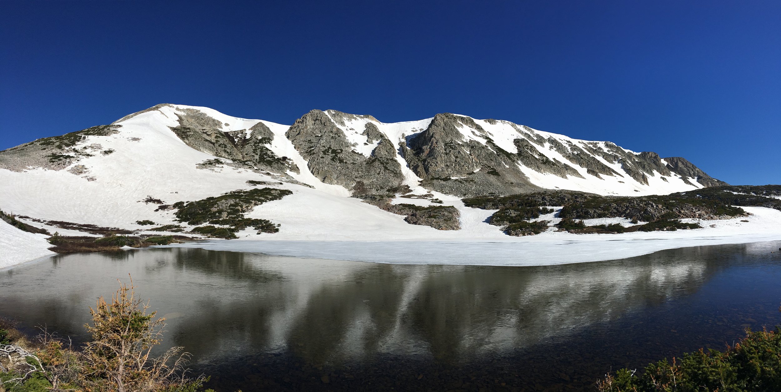
The full view of Medicine Bow Peak from the overlook on Highway 130.

Looking at Old Main and the surrounding couloirs from the pass between Sugarloaf Mountain and Medicine Bow Peak.
Looking up at the East Ridge and couloirs from Klondike Lake.

The Marie Couloirs directly above the highway and Lake Marie.